Donovaly – Šachtička
Duration: 3:40 h | Distance: 13,2 km
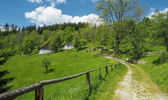
If you start from Donovály following the green tourist sign, you can follow the educational path Donovaly - Šachtička. Almost half of the route goes through meadows and pastures, the other part is rather forested. With breaks, you can easily walk it in 4 hours. On this easy hiking route, you will find 11 information boards, from which you will learn something about nature conservation, the use of the landscape by man, and also interesting things from history.
Donovaly – Liptovské Revúce (Vyšná Revúca)
Duration: 3:55 h + 1:15 h to Vyšná Revúca | Distance: 8,7 km + 5 km
This hiking route begins by climbing the red tourist sign from the village to the highest peak of Donovál - Zvolen. From there you will have a beautiful view of the entire center. From the top of Zvolen, follow the yellow tourist sign in the direction of Malý Zvolen and Končita, and the route leads to Nižná Revúca. While walking through this striking village, it is definitely worth visiting the fabulous Bird Garden in Vyšná Revúca. You can get back by bus to Liptovská Osada and then by connection to Donovaly.
Donovaly – Kalište
Duration: 1:35 h |Distance: 5,7 km
An undemanding route leads to the former mountain settlement of Kalište, following the yellow tourist sign in the direction of the settlement of Bully. This settlement was burned down during the Slovak National Uprising and life in it never recovered. Today there is a permanent exhibition of the SNP Museum and an educational trail "How residents of Kalište lived".
Donovaly – Staré hory
Duration: 4:55 h | Distance: 17 km
The route starts from Donovál following the green tourist sign towards the village of Bully. You will also pass by the Na Kráme shelter. You have to stick to the green tourit sign until Žiare, where it intersects with the yellow tourist sign. After about 25 minutes along the yellow tourist route, you will come to the Dolný Šturec saddle, where you can get water near the cabin. At the signpost at the crossroads, follow the forest path to reach the yellow tourist sign and continue to the Richtárová settlement. From there it is about 25 minutes to the center of Staré Hory.
Donovaly – Korytnica
Duration: 1:15 h to the crossroads, approx 20 minutes continuation directly to the village | Distance: approx 6 km.
A simple hiking route follows the yellow tourist sign from Donovál through Mišúty to the Žarnovka valley. By the main road, you will find yourself at the crossroads to Korytnica. In the past, it was known as a famous spa, where even Emperor František Jozef allegedly went for treatment. Today, you can drink here the coldest healing water in Slovakia, from the still plentiful springs, and at least try to imagine what it might have looked like there in the past. The cool valley is ideal for walks, especially during hot summer days.
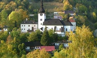
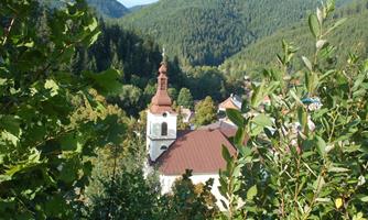
Donovaly – Špania Dolina
Duration: 4:00 h | Distance: 13,9 km
It is one of the most popular routes for domestic and foreign visitors. At the beginning of May, a tourist march from Donovál to Špania Dolina is also organized every year, with increasing participation. The route starts following the green tourist sign from Donovaly towards the village of Bully. If you take a short detour towards Polianka, you can see a replica of the mining aqueduct, which in the old mining days brought water from below Prašiva in the Low Tatras to Špana Dolina. The water supply is guarded by a wooden sculpture of Baltázár. The route leads past the remains of the aqueduct and beyond. You can find another permonian behind the shelter on the Krám under Jelenská skála. From Žiarov, follow the yellow tourist sign to the Dolný Šturec saddle, and from there follow the red tourist road straight to Špana Dolina, a former mining village with preserved historical buildings.